
By Stuart and Sally McLaughlin.
The idea to Circle the Zirkel in Colorado, USA, was born during a ski trip to France in February when our American friends, Karen and Linda, asked if we would be interested. On 14 July 2025, Sally and I boarded a United Airlines flight to Steamboat Springs, Colorado to join them on this adventure along with Karen’s brother Steve and his son Joe.
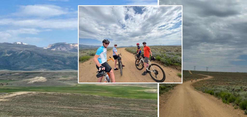
The USA has 1.3 million miles of gravel roads. These are usually roads used by cars and farm vehicles alike, rather than the cycle paths we have in the UK, although there are narrower single-track sections too. For our ride, traffic was minimal as we were out in the wilds with very few properties apart from the odd ranch. On many sections, we saw more deer and antelope than vehicles!
Steamboat Springs, in northern Colorado, has a reputation for gravel riding. It is home to Moot bikes who make some of the best gravel bikes in the world. I was lucky enough to borrow one for this trip and it was amazing!
Our Circle the Zirkel route (https://thedirtyroads.com/circle-the-zirkel/) would involve over 145 miles with 9,000 ft of elevation over 4 days. Although this may not appear a great challenge to many club members, 95% of the route was on gravel; deep, loose stone chips that made gaining traction very difficult on some sections, especially the climbs. Furthermore, there was a great deal of wash boarding where the gravel forms into ridges across the road which was not only energy sapping but also made all contact points very uncomfortable, especially when descending at speed. To relieve this discomfort, we learnt to use the mountain bike technique of coming out of the saddle with our feet level and using our knees and elbows as shock absorbers. Moreover, we were in the high Rockies with the whole ride taking place at over 6,600 ft (2000m) altitude. We started the ride with only 3 days to acclimatise, when it is recommended that athletes (if that’s what we can be categorised as) take one to two weeks to become fully accustomed to high altitude. Both Sally and I were certainly gasping for air on the ascents!
We had two support vehicles to carry our camping gear and ensure we had supplies along the way. It was hot and, at this altitude, we drank far more than we would in the UK; so being able to top up bidons along the way was much appreciated. This meant that two of the group did not ride all the time (although as overseas visitors, Sally and I did!)
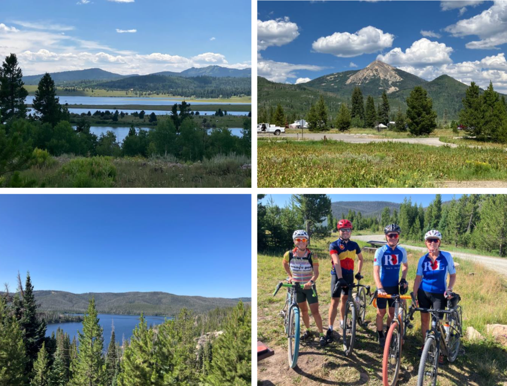
Day One: Steamboat Springs to Lake John (27 miles with 1200 ft elevation)
The first day should have been longer and included far more elevation. However, locals recommended we checked out the first part of the ride, up and over the Buffalo Pass, due to the reputed difficulty of the terrain. A couple of days before the ride we drove this section in Linda’s massive 4 x 4 truck. The truck struggled up the pass and it was virtually impassible on a gravel bike due to the number of boulders and the broken-up roadway. Perhaps a good full suspension mountain bike would have coped. So, it was disappointingly decided we skip this part on safety grounds.
This meant we had a gentler intro to the ride although there were still 6 climbs as we wound our way through open sage brush landscape with the mountains to our left. All six of us set off at the start of the ride but Karen and Linda then doubled back after an hour to retrieve the support vehicles. With four riders remaining, we weaved our way through the stunning South Delany Butte Lakes with many water birds and people fishing hoping to catch their lunch! On this section we saw numerous antelope and deer running through the brush and crossing the road ahead of us, as well as eagles and other hawks sweeping majestically across the skies.
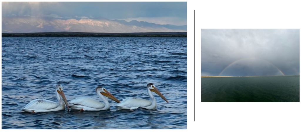
Our first overnight stop was at Lake John, an RV park next to a beautiful lake where pelicans came to feed. Here, a typical Colorado thunderstorm hit us but, fortunately, we were in an RV rather than under canvas. The rainbow created by the storm across the lake was spectacular!
Day Two: Lake John to Hogg Park (45 miles, 3,700 ft of elevation)
This was by far the most challenging day not only in terms of distance but also elevation. My Garmin told me that we had 10 climbs in total including two 4-mile ridges to encounter. We started with the sage brush terrain of the previous day before cutting towards the mountains where we enjoyed beautiful pine forests running next to a creek with beaver dams and the distinctive pools they create clearly evident. That was where our first major climb started on very loose gravel snaking our way up and over a ridge with numerous switch backs on the way. We zig zagged across the road to try and find more purchase on the strength sapping surface. At this point the clouds gathered and we had to phone ahead in case we needed rescuing.
As Brits rain did not bother us but the risk of lightning strikes in the mountains with trees all around was a concern. Fortunately, we only had a few spots of rain (with a bit of hail) but nothing more, so we soldiered on.
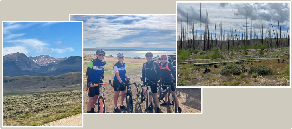
The second 4-mile climb was through an Aspen forest which was equally stunning whilst equally challenging. As we reached the peak of the ridge, we saw our first evidence of devastating forest fires which ravage certain areas of the mountains of Colorado every summer. We also found a cabin belonging to a distant relative, but they were not at home!
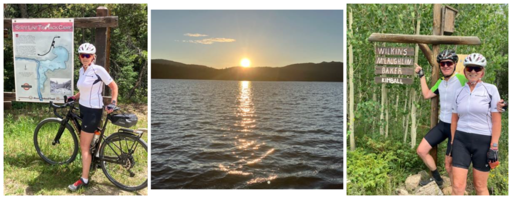
The end of our ride today brought us across the state line into Wyoming, the least populated US state and we certainly felt remote. There were no towns or habitation within many miles of the very basic camp at Hogg Park – no showers here, just a very basic toilet where flushing was not an option! However, the scenery was spectacular as the sun set over the lake.
Day Three: Hogg Park to Steamboat Lake (30 miles, 2,600 ft of elevation)
Until now, our friend Karen had driven the support vehicle and only ridden short sections with us but today she switched with her brother, Steve, to join us on what proved to be another challenging day of climbing. This time my Garmin told me we had 8 climbs, two of which were over two miles long. The first climb took us up and out of the Hogg Park bowl to give us stunning views back over the lake.
The gravel on this section was by far the worst, incredibly deep and loose stone chips making traction very difficult. This was made tougher by the fact that although slightly shorter, the climbs were steeper. On one of the two mile climbs, rather than gravel, there was a section of hard packed mud which was more suited to mountain biking. It was rutted and there were exposed rocks which meant you had to choose your line very carefully to avoid a tumble. Despite the challenge, this was my favourite part of the whole ride due to its technical difficulty.
Our ride on this day ended at Steamboat Lake that offers a huge range of water-based activities and brought us back into civilisation – a proper shower block! From here we had a wonderful view of Hahns Peak, an extinct volcano with a fire viewing tower on the top used to spot forest fires.
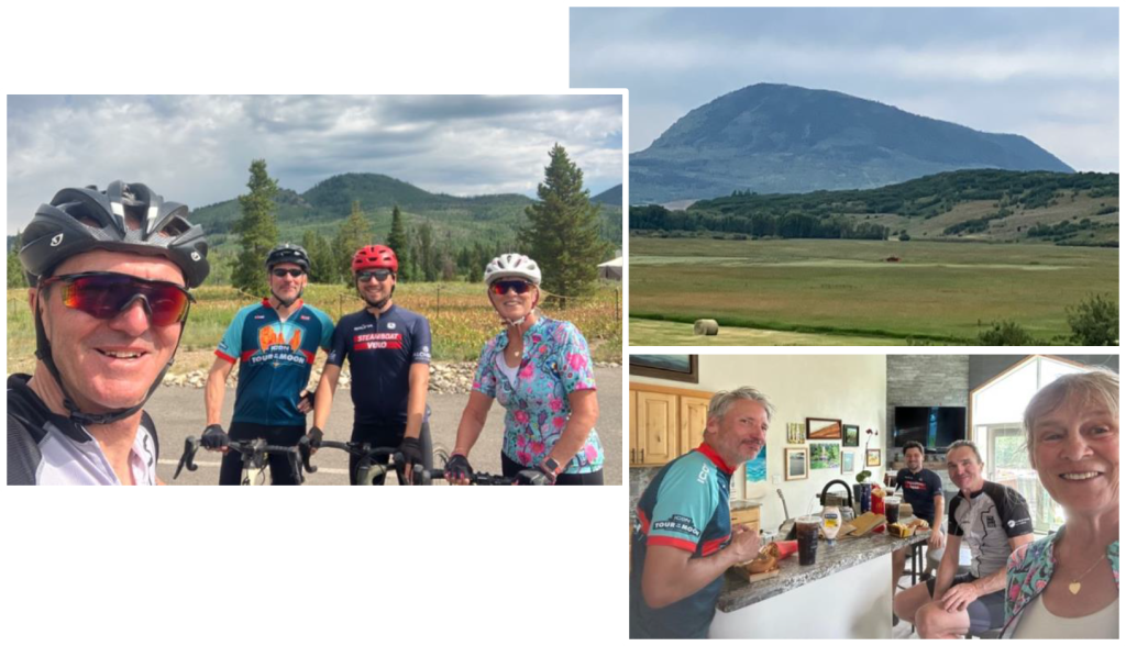
Day Four: Steamboat Lake to Steamboat (40 miles, 2,000 ft of elevation)
On the final day we made our way back to Steamboat from where our journey began. Although we lost a lot of elevation, the route still included 7 climbs (according to my Garmin) and also the only significant section of tarmac on the whole ride as we came back into the town.
The route also brought us past Sleeping Giant (see above), a very distinctive local landmark, which we circumnavigated a couple of days after completing the Circle the Zirkel challenge (30 miles and 2,000 ft of elevation). It was at this point that Steve suggested we had McDonalds when we got back. Although neither Sally nor I are fans of the Golden Arches, a Big Mac, fries and coke (US portion sized) was just what we needed to help our recovery and celebrate the completion of Circling the Zirkel mountains!
Stuart and Sally McLaughlin
July 2025